Humans have always wanted to know what the weather has in store for them, and have come up with a whole load of ways to predict what’s coming; some better than others.
Weather forecasting as we know it began in earnest in the nineteenth century, when the invention of the electric telegraph revolutionised long-distance communications and made it possible for information about incoming weather to travel faster than the weather itself. Since then weather forecasting has become ever-more accurate, with improvements in the technology of reporting and communicating, as well as in the predictive models, making it possible for us to know the future weather in greater detail than ever before.

The data collected by weather stations across the world is translated by algorithms into predictions about the weather which is coming. But while some raw data is freely available to those who wish to use it, other datasets are locked behind towering paywalls, and all output predictions are generally the closed property of big forecasting companies.
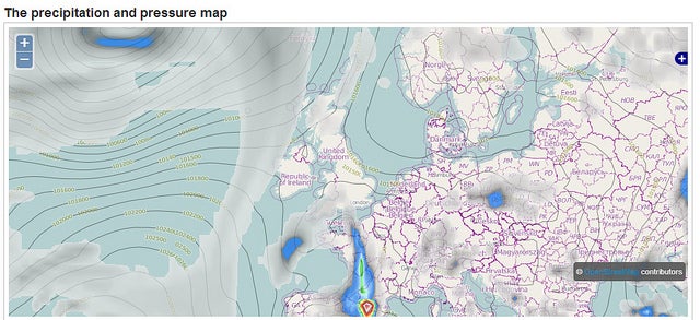
Two projects which have emerged recently to challenge this are OpenWeatherMap.org and OpenMeteoData.org.
From Olga Ukolova from OpenWeatherMap:
We believe that enthusiasts joined by one idea could achieve more than large companies. We believe that meteorological data must be available, free, and easy-to-use.
An open weather forecasting service has the ability to harness the input of enthusiasts around the world, to produce forecasts of greater precision and detail than can be achieved by monolithic companies. Inspired by the success of community-driven knowledge creation in cases like Wikipedia and OpenStreetMap, the guys at OpenWeatherMap are looking to improve the quality of available information, while at the same time wresting control from the hands of profit-driven corporations:
The project attracts enthusiasts to the process of data collection and estimation of data preciseness that increases accuracy of weather forecasts. If you have a weather station you can connect it to OpenWeatherMap service. You will get a convenient interface for gathering and monitoring data from your weather station. And you can embed the weather station data into your home page.
The results are available to developers openly and for free:
Mobile apps developers can receive any weather data for their applications by using JSON / XML API. Lots of weather applications for Android and iOS use OpenWeatherMap as weather data source. By the way the data can be received from WMS server and can be embedded into any cartographic web-application.
Web-application developers that use cartographic services can easily add weather information to it. OpenWeatherMap provides libraries for OpenStreetMaps and Google map. Plug-ins for Drupal and other CMS are available too.
Originally posted on the Open Knowledge Foundation blog. Reposted using Creative Commons.


Comments are closed.